Heads Up! Big storm coming to Cali and SW

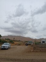
So, how's the weather in the SW right now?

Here in Utah...late July through early September we get the 'monsoonal flow'

Strong high pressure system off to the south east

Low pressure system over to the west..perfect set up for plenty of rain as per linky

Summer '23 has been very active even long before the Hillary storm

Humidity levels really jump too.....normal 7-10% climbs up to 45-50%------yuck !

Will be interesting to see what the Hillary storm brings to all the SW

After our mega winter snow pack...many reservoirs still holding 80-90% capacity


Clouds are rolling in. No wind at all right now.
 

Attachments

  • IMG_20230819_155101204.jpg
    IMG_20230819_155101204.jpg
    104.6 KB · Views: 17
We went to Costco this morning. Not in panic mode just our regular stock up day. Place is a mess! No room to move,shoulder to shoulder. They have generators and those are flying off the shelves.

Wonder how many will be returned next week?
Just got back from Sam's Club in Las Vegas. Normal beans and coffee run. Everything normal, no unusual shopping patterns, etc. No line at self check out. Was a line for gas, but that's ops normal.
Planning on a typhoon party at the local pub tomorrow night. I spent much of my career in the military in the Far East. Hurricane party doesn't sound right to me.
 
It's being reported as a Cat 1 hurricane now, and judging by the radar picture it's more probably down to a tropical storm. Looks like it's breaking up a lot and there is no defined eye any longer. I suspect the California and Nevada desert will see a lot of rain, but at least it looks like wind won't be that much of a problem. On another note, my windows are open and AC is off for the first time since late June.
 
Directly in the path NE of San Diego. We'll see what happens Sunday afternoon/evening. Predictions are pretty tame. 30mph wind and 2-7" of rain. Life was normal today. People even washing their cars.
 
It’s expected to stay together and head Northward to Canada, then vector East and track across most of it.
 
It’s expected to stay together and head Northward to Canada, then vector East and track across most of it.
Here is a screen shot of that prediction. I’m just on the edge of it at the Canadian border north of Idaho. We haven’t had any rain to speak of this summer but have thunder showers predicted for Tuesday. I have a trip planned for Thursday down into Montana.

F9AD81F3-159E-44C4-9083-F87437B6E512.jpg
 
Looking at the swirling satellite photos it looked like eye will be half way between San Diego and Phoenix, but this projection shows it will almost hit San Diego dead on. It apparently is now category 1.

A9936EE0-B4A4-401A-93A0-1FF135B369B1.jpeg
 
Last edited:
There will be a bit wind damage because the path hasnt experienced this before, and maybe tornados on the east side of the eye. Thankfully this seems to be not a catastrophic storm.
 
I checked the Del Coronado beach cam before sunset and the wind speed is at 15 mph and the palms were lightly waving, indicating the wind speed indicator is probably working. It is raining. Not too exciting so far.
 
Back
Top