Okay, Chris, let's see how you do on landmarks other than buildings. Where was this picture taken? You may either name the red hill in the background, or you may describe the location.
I used to live just off of Red Rock Rd on the Nevada side. I've travelled past that area hundreds of times and have hiked to the red rocks to take pictures for a photography class.
The problem with Bodie is that it's clearly in a fake state of arrested decay. Nobody can tell me they are not actively maintaining the buildings. I have been going to Bodie for 20 years, and if anything, it looks better each time.
LOL You're probably right!
Around here (Illinois), they'd probably just "over-restore" the whole place and make it kind of like a "Hollywood-meets-Disneyland" ghost town.
We went to Bodie a few months ago.the road was really bad in my f250.so bad that my tailgate fell off.I even bought the " I survived the Bodie rd" bumper sticker lol. It was gnarly.
Originally Posted By: css9450
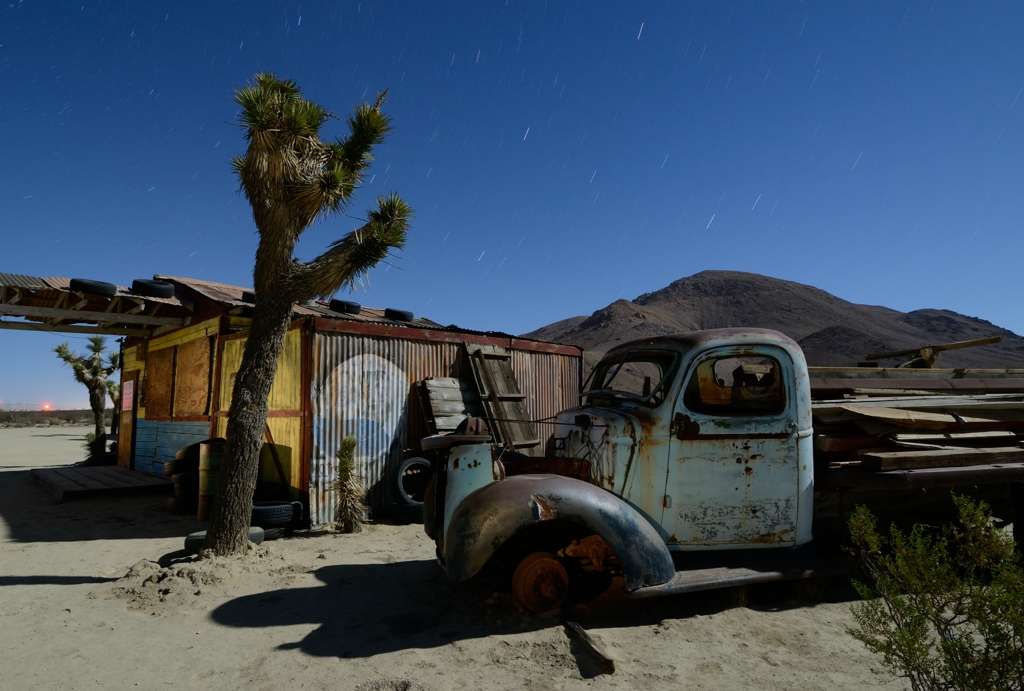
How about a nighttime, full moon pic? This one actually IS a movie set. How it remains unvandalized and graffiti-free is a mystery to me.
Its kinda between Mojave and Lancaster on a backroad near Silver Queen Mine. Its a movie set - they rent the place out and all the "props" there - the tree, the old truck, etc, can all be moved around if needed.
Since there are no more guesses, here is full disclosure:
I took the picture along the Bolinas Ridge Roadthat winds through the coastal range of Marin above Stinson Beach. The road offers great viewpoints and overlooks along a several miles long stretch of road. The water in the foregound is Bolinas Bay, which was created by and is part of the San Andreas Fault. Excluded from the picture, to the left would be Stinson Beach. The "finger of land" reaching out into the Pacific in the background is the westernmost part of the Point Reyes Peninsula, which is some 7 miles away as the crow flies or an hour by car.